Map services around the globe
Over the past years I've seen a lot of useful services with maps. Some of them disappeared, some changed into useless stuff, some of them are outdated. But there are also a lot of them which improved or are still a good resource for some reason.
I know people have quite different interests but I hope there are a few of them helpful for you.
Top street map services
My personal up to down ranking of free map services.
Google Maps material from the global player. Its map content has improved over the last years and local guides support to keep it up to date. For my holiday plans I like to use the street view to get an impression of my target destination - at last to view some pictures.
Also the user ratings and photos for shops, pups etc. are very useful in my eyes.
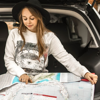
Google My Maps to create own maps with markers. Pretty handy to collect your private and business locations on a map so you can access it from any device or computer. I used it also in combination with my GPX routes to show tracks. Currently, I use it the most for my holiday plans to mark all point I want to visit & make some short notes for my personal use. For my next holiday I've already collected over 50 places to visit, not sure if I will manage all of them.
OpenStreetMap.com or in short OSM which is free to reuse. In Vienna you can also find planned streets or underground tracks which should be build in upcoming years. It supports also a huge amount of different items depending on the layer you choose, there is no other map having such deep details. Many map apps get their data from openstreetmap & I think no other project has this amount of people working on a map to keep it up to date.
OsmAnd.net for offline maps and navigation plus outdoor activities. A powerful tool if you are outside. It's a bit complex but once you defined the views and behaviors to match exact your needs you will never miss it. Big plus with the offline maps is to save battery if you are outside for the whole day. The usability is a bit different but it provides a wide area of functionalities - best for heavy users.
waze.com a community based car navigation specialist. Meanwhile, this startup was bought by google - make your own thoughts on this. It's designed for driving with car, it can give you hints about traffic jams or any other dangerous situation if someone else in the community detected it or the system detected it through traffic analysis of the users. The community base is constantly growing & this navigation app has the best usability I've seen for that purpose.
Brouter.de is intended for route planning but there is a nice feature within the map layers to display for outdoor hiking the color codes of the marked ways. You can add this overlay if you check the box in the "
Wandern (markierte Routen)" line to see which color codes specific tracks have. The website allows you also easily to create your on root with the pencil tool & it will calculate the route according to your selected routing profile (Bike, Car, Hiking, ...). You can download then the gpx file and import it wherever you need it then. It's realy easy and can be done quickly. Off-the-track routing is not possible. If tracks are not connected you might end up therefore in a bigger circle.
Alltrails.com bought gpsies.com and tried to integrate the service. A tool for tour planning, and sharing. An alternative tool if you want to draw or correct tracks from fresh. The app allows also a real-time tracking for your social community and you can manage all your routes and tours on the website, which needs some time to learn the handling but once understood it does the job. This solution is more for outdoor activities designed but I like the sharing of routes with friends for trips with the web service in social media.
The GPX track can be downloaded for further use which makes sense for many outdoor GPS devices.
GEOFABRIK.de has a map compare tool for the big players. This one I really like because sometimes when viewing a map I have the feeling that it's outdated or something is missing. With this tool you can compare maps views also from different providers for example to find out who has the latest satellite pictures or newest streets on the map or if a different map has additional information.
Bing.com the Microsoft service. The material is far away from being up to date but this is the reason for my visits. In case I want to see a older satellite picture I visit Bing, it's fast and has a good resolution. Especially if some areas had been pixelated in google maps you might see it in Bing maps.
Other interesting maps
Here is a mixtured list of other free map services. Some of them only for Vienna in Austria.
diefruehstueckerinnen.at provides a breakfast map. New reports are added on regular basis and also updated. There is a ranking and detailed information for each location they have visited plus notes of personal impressions. The community is mostly female driven, so they often value impressions & service heavier than price vs. food to get fed up. So this is more for girls than boys :-)
fahrradwien.at is a route planer especially for bikes. It will prefer in the planning bike lanes and will also try to avoid higher hills if possible. You will not need it if you are good by bike but it still can give you input for your route planning because the map should always be up to date if street directions etc. have changed. You will also see stations where you can refill air for your bike.
Flightradar24.com shows current airline traffic. You can select different map types and get also details on airplanes. It's most interest if you or someone you know is on a flight if you want to check the current position or maybe also the route they took.
Mapstr.com This is new to me and I have just read reviews. It an alternative to google my maps. The tool allows you to create your own map with your points of interest (POI) on. You can label them different like restaurants, photo points, ... or any other category you want to show on the map or you can also view all together. A big plus are personal notes and the possibility to share your map places with others.
Geocaching.com a worldwide treasure hunt game. You need to create an account to view the map. There are numerous places to find and visit beside different types of caches. Nice fun for the family. I like to use it also during holiday trips to find places which may not be in typical tourist guides as there are many hidden places used for caches.
GPS-TOUR.INFO is a portal for outdoor tours with GPX tracks. View tracks on the map, read recommendations and descriptions, download tracks on our mobile. Overall a very well designed helpful site. You can distinguish also between different sports & difficulty of the tour. Usually there are also user descriptions with details how to get there & things you might take care of to stay on the correct path.
Laerminfo.at portal for noise volume level in Austria. You can choose between traffic, train and airplanes to see how noise at specific places is. Keep in mind that new buildings or changed traffic routes might have changed the picture. It's a good source to compare areas if you feel the need for more silence.
mindmup.com free online mind mapping software. A great way to organize your thoughts or for brainstorming. I use it in combination with google drive to access and change my mindmap from everywhere I need to.
mundraub.org community to list fruits on public places. A community that informs where you can grab some food - if the time is right. It is still growing. The first time I saw it, only Germany was partially mapped but now it seems to go more and more around the globe. If you like nature and fruits this might be a site for you.
Vienna.at has a crime map from the city of Vienna. Get an overview on crime statistics of last years in Vienna. You can also select different types of crime. Keep in mind how reliable statistics are & that not all criminal activities went public.
Wien.gv.at/stadtplan official site, can show you lot of useful stuff in Vienna. You can spend hours of watching this map finding interesting markers. Check out also the other map services on this page.
If you live in Vienna I recommend taking a closer look.
Wien.gv.at/verkehr/parken/kurzparkzonen should you visit if you plan a trip by car in Vienna. In most areas you have to pay for parking and this site can help you to get an overview. There is also a map with regular zones available but still you need to watch out for individual restrictions.
wikimapia.org community for free worldwide area descriptions. It's one of my favorite maps I check out when going on holiday to spot places worth to visit. There are very often places mapped you will not find on common other maps for example, bunkers build near the border during the cold war.
Feel free to leave a note if you think there is a good map service missing!


Comments
Post a Comment